Augmented Urban Reality 2014, United Kingdom, London
Augmented Urban Reality: Arts Trail 2014
Augmented Urban Reality Project, a mobile augmented reality experience developed by University College London in association with augmented reality specialists, Holition. The aims were to explore alternative ways to experience and engage with the city using augmented reality, and to increase interactions of the participating artists and their environment.
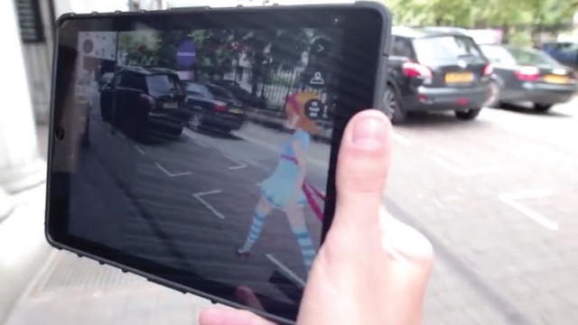
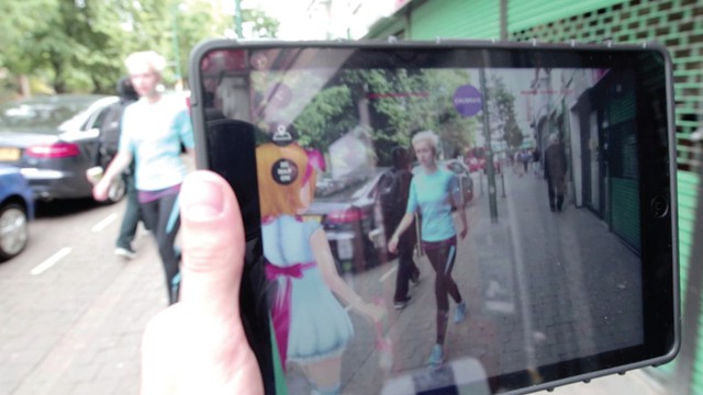
The Augmented Urban Reality Project demonstrates a new urban AR experience beyond simply overlaying points of interest, floating post-its or 3D models on a display. It provides visual and spatial orientation, and an immersive and intuitive experience. The approach supports a physical and digital spatial narrative as people move between the various art trail points.
Details
Building or project owner : University College London in collaboration with Holition Ltd
Project artist/ concept/ design/ planning : University College London in collaboration with Holition Ltd
Project co-ordination : Ava Fatah, The Bartlett, University College London and Jonathan Chippendale, Holition.
Interaction design/ programming : UCL: Ana Moutinho, and Ava Fatah. Holition: Shanaka Senevirathne, Chirag Grover and Russell Freeman
Descriptions
Facade type and geometry (structure) : The aim is to create new spatial and social narratives and engage people with invisible aspects of their environment through the animated character’s movement and behavior.
Resolution and transmitting behaviour : In the Augmented Reality View, the user follows a walking 3D digital character, which guides the user in the exact direction of selected places, following a defined route. The character responds to the users’ movements, altering its pose, speed and animation based on the users distance.
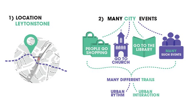
Urban situation : the system chooses the shortest path between the user location and the selected places and shows a path over a 2D map. In the AR View the user has the choice to enable or disable a 2D map overlay, registered to the real visualized world